


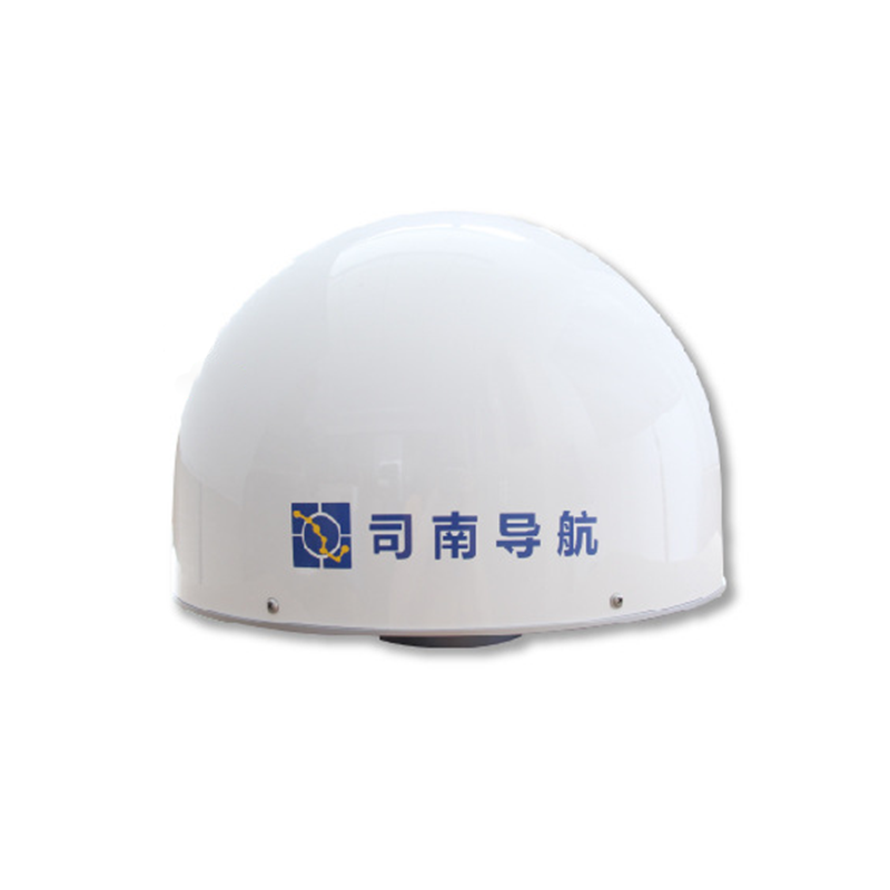
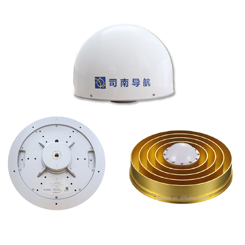
Product Description
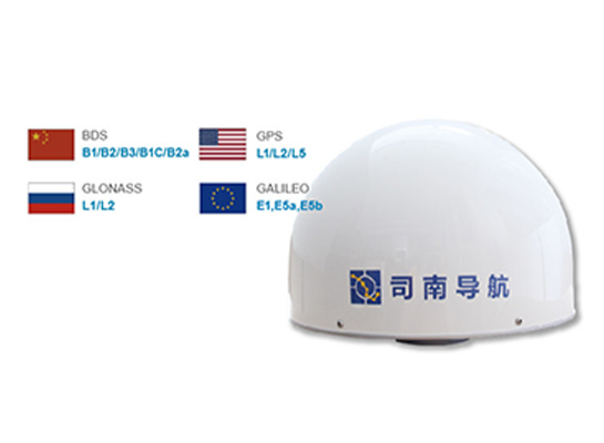
Frequency bands and system compatibility
Four-system full frequency: Support Beidou, GPS, GLONASS, GALILEO four global satellite navigation system full frequency signal reception, can make full use of multi-system satellite resources, greatly improve the reliability and accuracy of positioning
Product parameters
| Antenna performance | Frequency range (MHz) | BDS B1,B2,B3 | Working environment | Operating temperature (°C) | -45~+85 |
| GPS L1,L2,L5 | Storage temperature (C) | -55~+85 | |||
| GLONASS L1,L2 | humidness | 95% non-condensing | |||
| Galileo E1,E2,E5a,E5b | Waterproof and dustproof | IP67 | |||
| Polarization mode | Right-handed circular polarization | antistatic | Contact discharge 4K, air discharge 8kV 5 times each without damage | ||
| Antenna beam range | Azimuth :0°-360° Pitch :10°-90° | ||||
| Maximum gain (dB) | 6 | Salt spray resistance | Spray time 2h, spray interval storage time 22h, after 3 cycles, the work is normal | ||
| Axis ratio (dB) | ≤3.0 | ||||
| Phase center error (mm) | ≤1.5 | Vibration resistance | After the impact test with a frequency of (1~30)Hz and a single amplitude of 0.75mm on the three mutual vertical axes for 50min, the structure was intact and the operation was normal; After the impact test with a frequency of (30~55)Hz and a single amplitude of 0.25mm on three mutual vertical axes for 25min, the structure was intact and the work was normal | ||
| Output voltage standing wave ratio (VSWR) | ≤2.0 | ||||
| Port impedance (Ω) | 50 | ||||
| LNA performance | LNA Gain (dB) | 50±2 | |||
| Noise factor (dB) | ≤2.0 | ||||
| Input-output voltage standing wave ratio | ≤2.0 | ||||
| In-band flatness (dB) | ±2 | ||||
| Differential delay (ns) | ≤5 | strike | After 18 shock tests with an acceleration of 50m/s2 and a duration of 18ms, the antenna is in good structure and works normally | ||
| Operating voltage (V) | 3.3-12VDC | ||||
| Working current (mA) | 50 | ||||
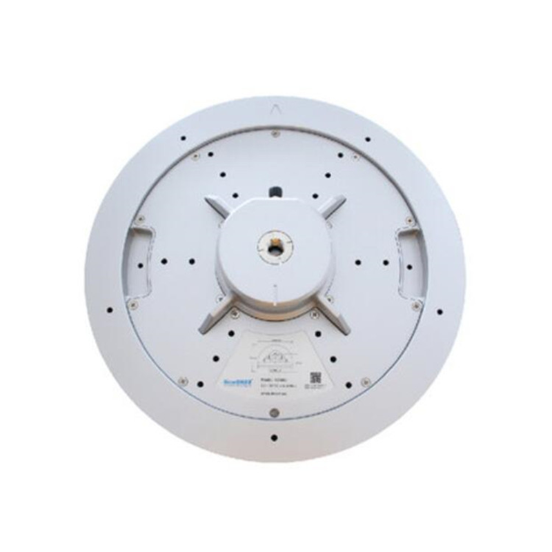
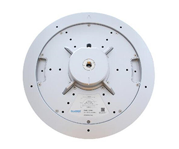
| Structural characteristic | Joint type | TNC-K | fall | After the antenna fell free twice at a height of 1m, the structure was intact and the operation was normal | |
| Antenna size (mm) | φ379.5x296.5 | ||||
| Installation mode | 5/8"X11(inch) threaded mounting hole | MTBF (h) | ≥10000 |
Technological innovation and advantages
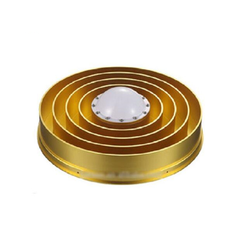
Multipath suppression: The use of choke design, effectively inhibit the multipath effect. In complex environments, such as urban canyons, mountains, etc., it can significantly reduce the interference of reflected signals to direct signals, ensure that the receiver receives pure satellite signals, and thus improve positioning accuracy.
High low elevation gain: Strong tracking ability of low elevation satellite signals to ensure that in the case of poor satellite distribution or serious occlusion, still can receive enough satellite signals, maintain the normal positioning function of the system, improve the positioning availability
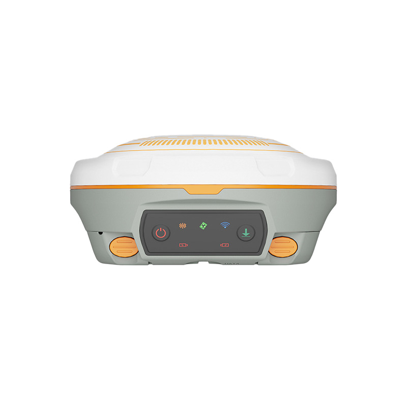
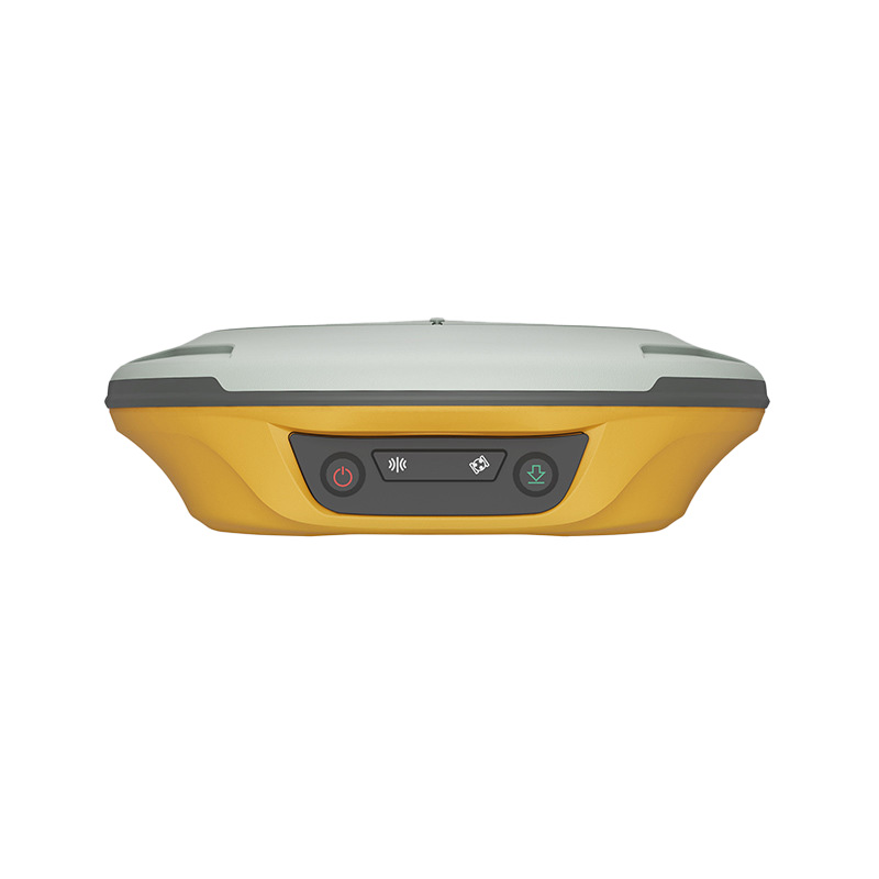
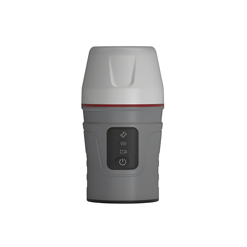
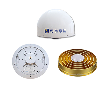
Product Display
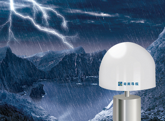
Designed to industrial standards
Waterproof and dustproof up to IP67,
Not afraid of sand, dust and water immersion, stable operation in complex industrial environment,
Ensure accurate signal reception and efficient application.
Built-in low noise amplifier
Enhance the signal and filter out interference,
Improve the anti-interference capability of the system,
Stabilized satellite signal reception and analysis,
Escort high-precision positioning.
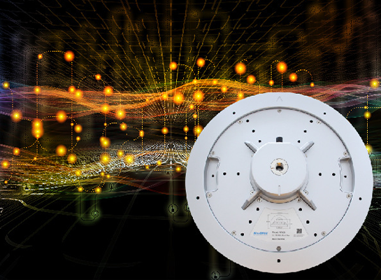
The AT600W GNSS is ideal for high precision positioning
Support BDS B1/B2/B3, GPS L1/L2/L5, GLONASS L1/L2,
Galileo E1/E5a/E5b signal
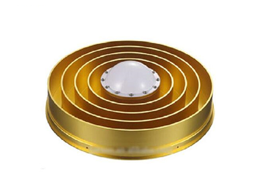
Use 3D choke design
Omnidirectional suppression of multipath effects,
Improve positioning accuracy and stability,
Ensures accurate signal locking in complex environments.
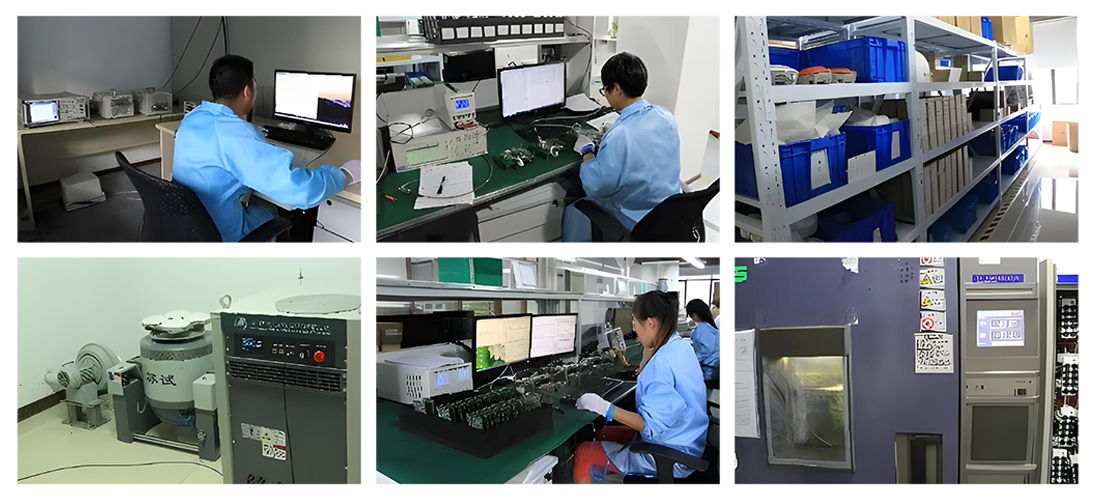
Quality Control
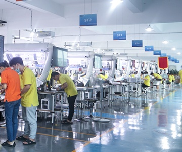
Raw material control: According to the industry demand, global select suppliers, with high-precision equipment to strictly screen raw materials from electrical performance, mechanical strength accuracy and other dimensions, to ensure that the quality exceeds the industry standard, build a solid foundation of high quality products.
Production process optimization: Customize the fine process according to the characteristics of the application field, automatic precision assembly for the production of geographic information acquisition equipment, modular assembly for the manufacturing of fine agricultural navigation equipment, and set up multiple detection points to ensure the accuracy of each link and product consistency, and meet the requirements of high-precision scenarios.
Performance verification system: Build a comprehensive and targeted verification system, simulate the actual scenes of various industries in depth testing, safety engineering products to do extreme environmental reliability verification, industrial measurement products and professional instruments compared calibration, only qualified products to enter the market, to provide users with reliable satellite navigation solutions.
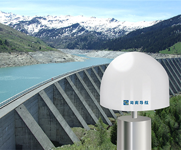
Application Cases
Suitable for many fields: widely used in geodetic mapping, waterway mapping, precision agriculture, deformation monitoring, geological disaster monitoring, military fields, etc.


Company Introduction
Sinan Navigation integrates the great achievements of China's high-precision GNSS technology, has a local R & D team specializing in high-precision GNSS core technology for many years, and more than 40 main technical backbone has won provincial and ministerial science and technology awards. Under the leadership of industry leader Dr. Wang Yongquan, Sinan Navigation has broken many foreign technical barriers, broken through the key technical bottlenecks of high-precision GNSS core algorithms, chips, boards, receivers, applications and industrialization, and developed a number of mature high-precision multi-mode and multi-frequency GNSS boards and receivers, filling the gaps in the field of high-precision GNSS at home and abroad for several times. At the same time, it is also the first satellite navigation enterprise that truly realizes the industrial application of Beidou in China.
Following the trend of compatibility and interoperability of the world's four major satellite navigation systems, Sinan Navigation flexibly meets the differentiated needs of users in different industries. Its business covers traditional surveying and mapping, geographic information, intelligent transportation, fine agriculture, machinery control, safety engineering, industrial measurement and other high-precision application fields, and its sales network covers more than 20 countries and regions around the world.
Sinan Beidou Industrial Park, with a total construction area of about 26,000 square meters invested by Sinan Navigation, is planned to be officially put into use in 2015, as the main research and development, production and application center of Beidou high-precision GNSS board in China, and will become a Beidou industrialization base that drives Shanghai, radiates the whole country and affects the world.

Cooperative partner

Service
Sinan Navigation is committed to providing customers with comprehensive, timely and professional after-sales service to ensure that customers have no worries in the process of using products:
Technical support:
We have a professional technical team, ready to answer all kinds of technical problems encountered by customers in the process of product installation, commissioning and use. Whether by phone, mail or online customer service platform, customers have quick access to technical experts for detailed and accurate technical guidance to ensure that products run smoothly and perform at their best. For example, for customers who are using high-precision positioning devices for the first time, technical personnel will patiently explain the operation process, parameter Settings, and solutions to common problems of the equipment to help customers quickly get started.
Training Services:
Provide customized training courses for customers, according to customers in different industries and application scenarios, in-depth explanation of product features, operation skills, and maintenance points. Training methods include on-site training, online training videos and operation manuals, etc., so that customers can choose learning methods according to their own needs, so that customers' technical personnel can master the use and maintenance skills of products, and improve customers' own technical capabilities and operational efficiency. For example, in the field of agriculture, special automatic driving system training is carried out for farm staff, so that they can learn how to set seeding and irrigation parameters according to the actual situation of the field, and give full play to the advantages of the product.
Repair and maintenance:
A complete maintenance service network has been established throughout the country and even around the world to ensure rapid response to customer maintenance needs. Once the product fails, customers can contact the local maintenance center through convenient repair channels, and the maintenance team will quickly diagnose the fault and take effective repair measures, and replace the original parts to ensure that the quality and performance of the product are not affected. At the same time, we provide customers with regular product maintenance suggestions and services to extend the service life of products and reduce the cost of use. For example, regular cleaning of navigation equipment, inspection of line connections and software updates ensure that the equipment can maintain high-precision positioning performance after a long period of use.
Software upgrade:
Continue to pay attention to the industry technology development and customer demand changes, constantly optimize and upgrade the product software, and provide free software update services for customers. New software releases may add new features, improve positioning accuracy, enhance system stability, or optimize compatibility with other devices, so that customers can always enjoy the most advanced technology results, enhance product competitiveness and adaptability, and meet the evolving business needs of customers. For example, with the continuous development of satellite navigation systems, software is updated in a timely manner to support new satellite signals and algorithms, providing customers with more accurate and reliable positioning services.