


Shenzhen FASTLASER LiDAR Co., Ltd
 T1
11 Years
T1
11 Years
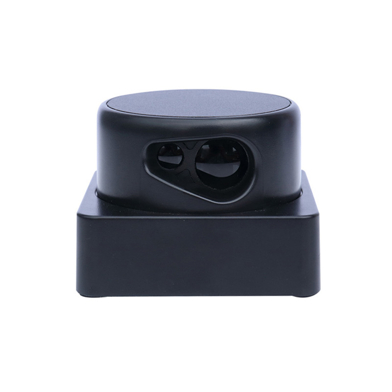
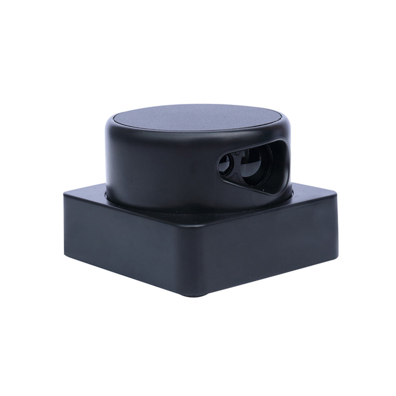
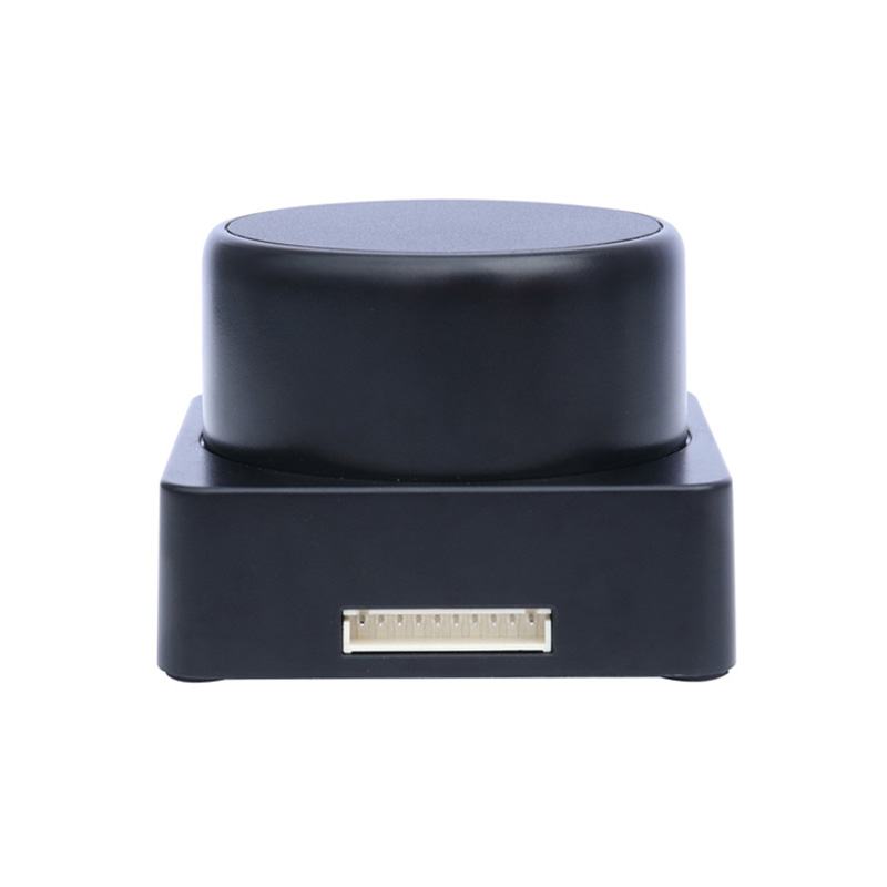

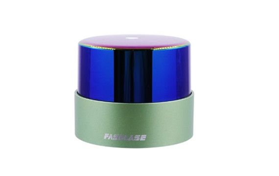
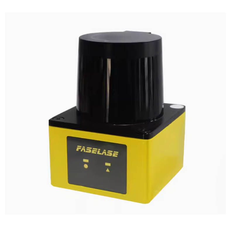
D-series 2D LiDAR
D-series industrial laser 360 degree range scanning radar for map mapping and robot positioning and navigation
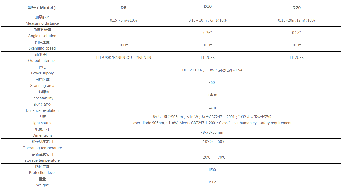
Measuring distance :
6m/10m/12m
Scanning speed :
10Hz
Power supply :
DC5V±10%,<3W;启动电流>1.5A
Scanning area :
360°
Repeatability :
±4cm
USD: 450-500
ablity:Monthly Output300
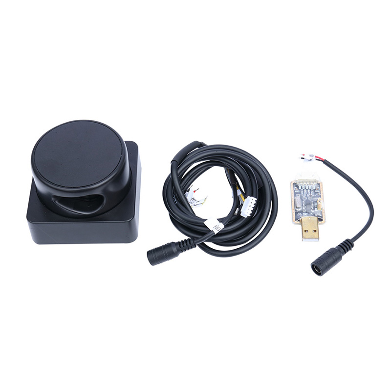
- Product Description
- Product Params
Product Description
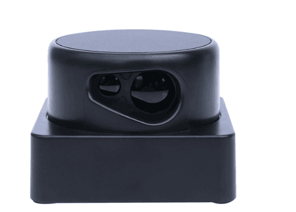
Product information:
The D series industrial laser scanning radar is a miniature laser radar developed by FaseLase. It integrates technologies such as fiber compression patent, electromagnetic non-contact rotation patent, passive optoelectronic coding patent, etc. It can clearly see objects within a 360 degree range of 20 meters around (with different types and performance), larger than the field of view of bees, and can generate planar point cloud map data of the space it is located in. These point cloud map data can be applied in fields such as map surveying, robot positioning and navigation, and human traffic detection.
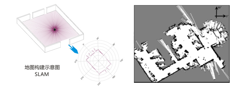
Map construction diagram
Characteristics
●SLAM composition accuracy can reach 1%;
● Zero position and angle accuracy;
● Support ROS robot operating system;
●External timing control for ultra dense installation, forming 3D scanning through CAN connection;
● Adopting human eye safety protection laser, in compliance with standards.
Product parameters
Applications
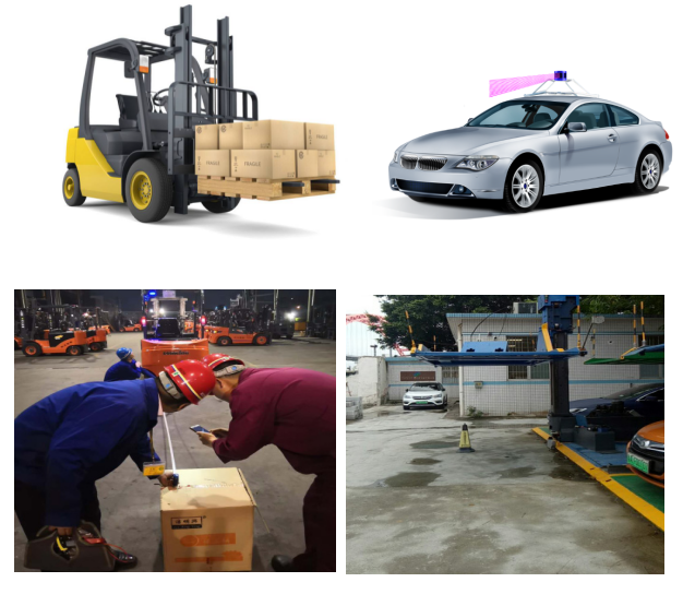
Indoor service robots, commercial mobile robots, indoor screen projection interaction, AGVs, forklifts, and three-dimensional parking garages
The D series industrial laser scanning radar is a miniature laser radar developed by FaseLase. It integrates technologies such as fiber compression patent, electromagnetic non-contact rotation patent, passive optoelectronic coding patent, etc. It can clearly see objects within a 360 degree range of 20 meters around (with different types and performance), larger than the field of view of bees, and can generate planar point cloud map data of the space it is located in. These point cloud map data can be applied in fields such as map surveying, robot positioning and navigation, and human traffic detection.
Map construction diagram
Characteristics
●SLAM composition accuracy can reach 1%;
● Zero position and angle accuracy;
● Support ROS robot operating system;
●External timing control for ultra dense installation, forming 3D scanning through CAN connection;
● Adopting human eye safety protection laser, in compliance with standards.
Product parameters
Applications
Indoor service robots, commercial mobile robots, indoor screen projection interaction, AGVs, forklifts, and three-dimensional parking garages
Recommended products
Regional laser grating T1×1/T3×3/T10×10/T20×20
Area laser grating 1m3m10m20m automatic machine tool safety protection sensor infrared grating
collect:0
D Series 2D LiDAR (D6/D10/D20)
Faselase LiDAR sensor for 20 m mobile robot navigation mapping path planning ROS
collect:0
FSB-30 micro laser ranging sensor
RGV obstacle avoidance sensor module for rapid and continuous measurement of moving objects
collect:0
FSB-50 laser ranging sensor
Fashi LiDAR 50m ranging module rapidly and continuously measures the RGV obstacle avoidance sensor module of moving objects
collect:0