


产品描述
高精度定位能力
- 多卫星系统兼容:支持北斗、GPS、GLONASS 等多卫星导航系统,可实现全星座跟踪,确保在各种复杂环境下都能快速、精准地接收卫星信号,获取定位数据,定位精度可达厘米级甚至毫米级。
- 先进的 RTK 技术:采用实时动态差分技术,通过与基准站进行实时通信,接收基准站发送的校正数据,从而实现高精度的定位,能够在短时间内快速收敛,获取稳定准确的位置信息
产品参数
| 信号跟踪 | 通道数 | 404 | 数据格式支持 | 数据记录格式 | CNB,Rinex等 |
| 定位 | BDS B1,B2 | 差分格式支持 | CMR,CMR+,RTCM2.x,RTCM3.x | ||
| GPS L1,L2 | 输出格式支持 | NMEA-0183,CNB(ComNav Binary) | |||
| GLONASS L1,L2 | 数据更新率 | 1Hz,2Hz,5Hz,10Hz,20Hz,50Hz( 可选配) | |||
| 精度和可靠性 | RTK精度RMS) | 水平:±(10+1x10⁻⁶XD)mm 垂直:±(20+1x10⁻⁶XD)mm | 通讯配置 | 网络模块 | 全网通4G |
| RTD精度RMS | 水平:±0.25m(1σ) 垂直:±0.50m(1σ) | 网络模式 | 支持NTRIP协议 | ||
| 单点定位精度 | 单频: H≤3m, V≤5m (1o,PDOP≤4) 双频:H≤1.5m, V≤3m (1a,PDOP≤4) | 蓝牙 | BT4.0双模蓝牙协议向下兼容2.1 | ||
| 测姿精度 | 航向角:0.2/R(R为双天线基线长) 横滚/俯仰角0.4/R(R为双天线基线长) | 惯导 | 内置惯导模块 | ||
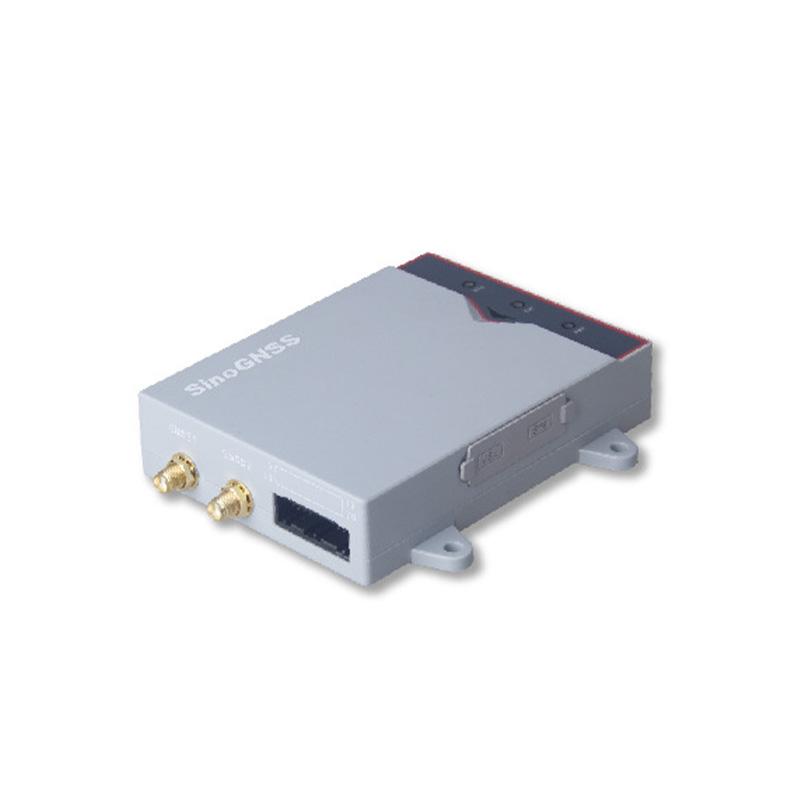
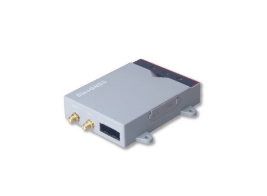
| 接口及电器指标 | 通讯接口 | 2个GNSS天线接口 1个20pin接口(2*串口,1*CAN,1*PPS,1*EVENT) 1个Micro USB口,1个SIM卡插槽 | |||
| 首次定位时间 | 冷启动<50s 温启动<45s 热启动<15s | 接收机电源 | DC+5V ~+27V | ||
| RTK初始化时间 | <10s | 功耗 | <3W(未接天线) | ||
| 信号重捕获信度 | <1.5s(快速) <3.0s(普通) | 环境特性 | 防尘防水 | IP54级 | |
| 初始化置 | >99.99% | 撞击和振动 | 抗2m自由跌落 | ||
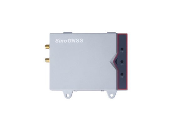
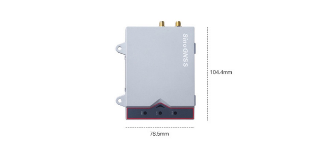
| 物理特性 | 尺寸 | 104.4X78.5X24.9mm | MTBF | 30000h | |
| 重量 | 185g | 工作温度 | -40℃~+75℃ | ||
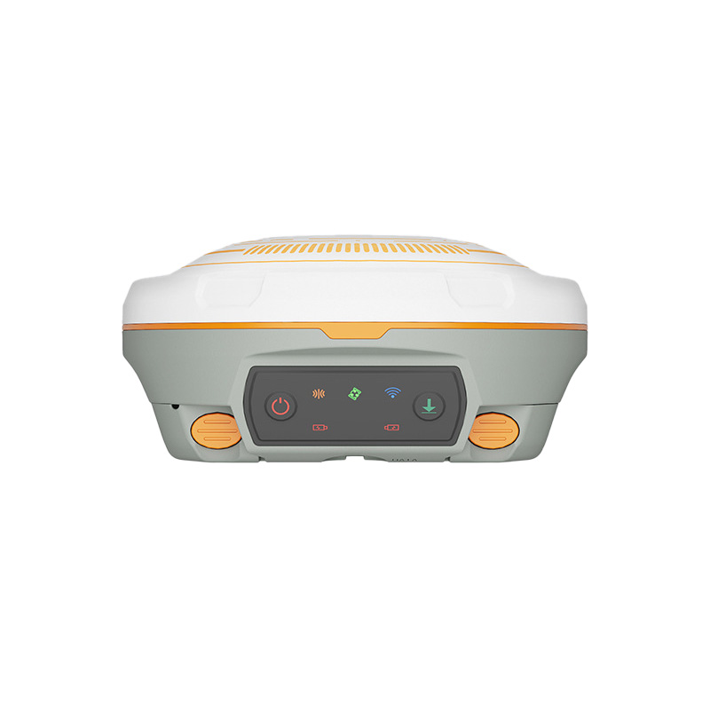
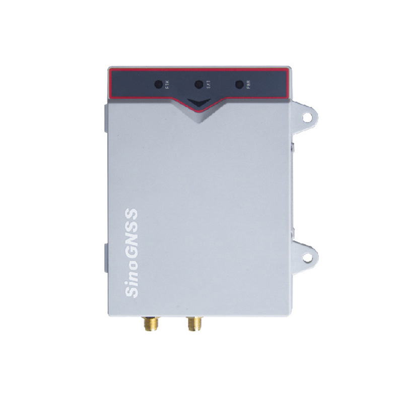
| 指示灯 | 1个电源灯+1个卫星灯+1个差分灯 | 存储温度 | -55℃~+85*℃ |
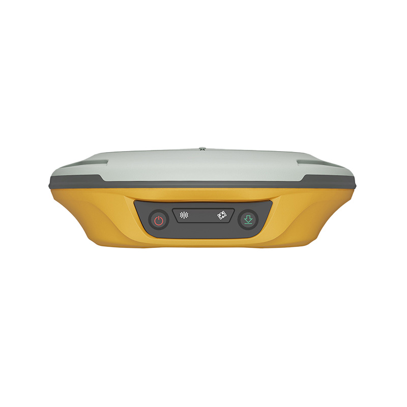
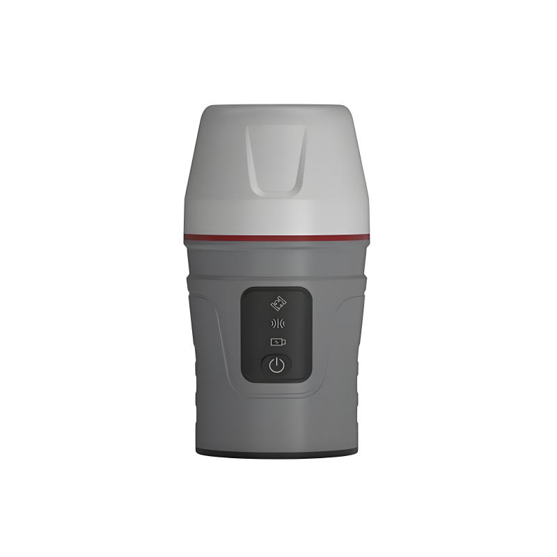
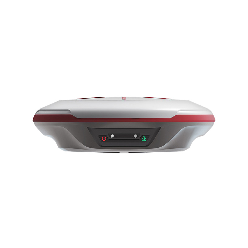
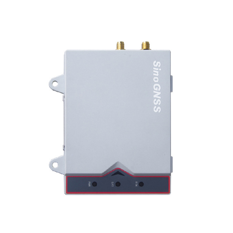
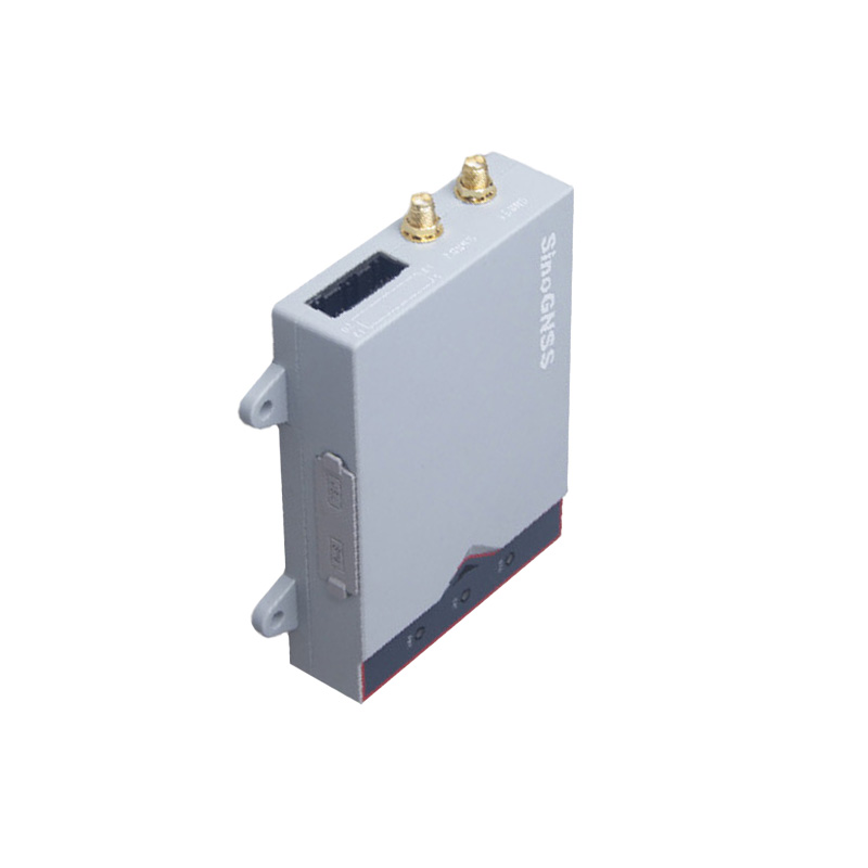
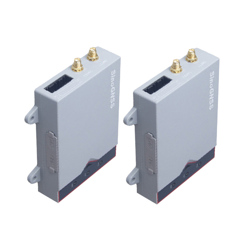
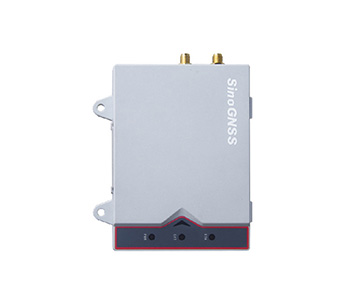
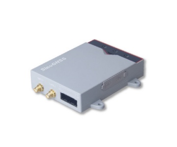
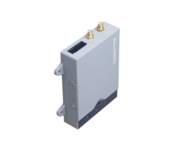
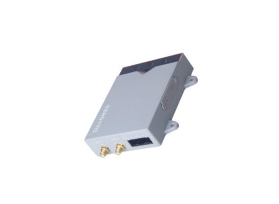
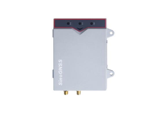
产品展示
内置惯导模块
内置高性能惯导模块,遇卫星信号短时中断,凭借惯性导航技术精密解算,仍可维持高精度定位,确保作业无忧,尽显卓越性能。
通信便捷
通信能力卓越,支持 4G 全网通,可无缝接入各运营商网络,保障数据高速稳定传输;采用 BT4.0 双核蓝牙技术,兼具高效连接与低功耗优势,拓展近距通信灵活性,便捷性尽显。
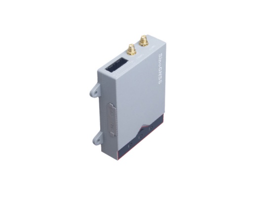
结构轻巧、坚固抗摔、防尘防水
尺寸:104.4X78.5X24.9mm 重量:185g
IP54级防尘防水,抗2m自由跌落
高稳定性与耐用性
设备采用工业级设计,具备高抗干扰性和高稳定性,可长时间无人值守稳定运行,有效加强了对无人机位置的跟踪和管理能力。
精准定位与导航
为无人机提供高精度的定位信息,结合无人机的飞控系统,实现精准的航线规划、飞行控制和姿态调整,确保无人机在飞行过程中的准确性和稳定性,可满足无人机在荒漠、海洋、山林等无公网区域,以及极限速度飞行环境下仍能保持厘米级高精度定位。
尺寸图
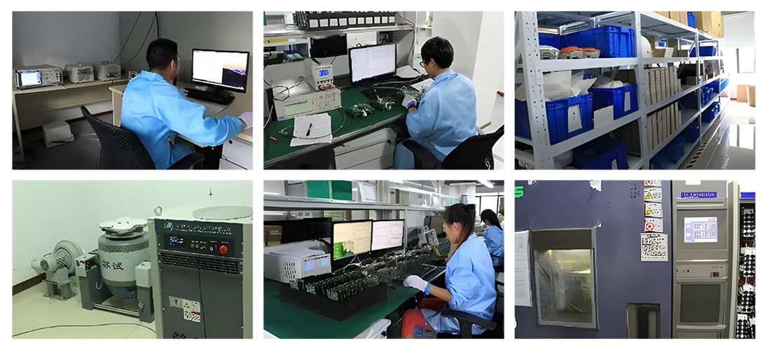
品控
原材料管控:依行业需求全球精选供应商,以高精度设备对原材料从电气性能、机械强度精度等多维度严格筛查,确保质量超行业标准,筑牢产品高质量根基。
生产流程优化:按应用领域特性定制精细流程,地理信息采集设备生产用自动化精密装配,精细农业导航设备制造用模块化组装并设多检测点,保证各环节精准度与产品一致性,契合高精度场景要求。
性能验证体系:建全面针对性强的验证体系,模拟各行业实际场景深度测试,安全工程产品做极端环境可靠性验证,工业测量产品与专业仪器比对校准,只有测试合格的产品才进入市场,为用户提供可靠卫星导航方案。
应用案例
适用于多个领域:可广泛应用于无人机、高精度车载定位、机械控制、精准农业和交通等行业。


公司介绍
司南导航集中国高精度GNSS技术之大成,拥有一支多年专业从事高精度GNSS核心技术的本土研发团队,主要技术骨干40余人次获得省部级科技奖项。在行业领军人物王永泉博士的带领下,司南导航打破了国外多项技术壁垒,突破了高精度GNSS核心算法、芯片、板卡、接收机、应用及产业化等关键技术瓶颈,研制出多款成熟的高精度多模多频GNSS板卡及接收机,数次填补了国内外GNSS在高精度领域的空白,同时也是国内首家真正实现北斗产业化应用的卫星导航企业。
司南导航紧跟全球四大卫星导航系统兼容互用趋势,灵活满足不同行业用户的差异化需求,业务涵盖了传统测绘、地理信息、智能交通、精细农业、机械控制、安全工程、工业测量等高精度应用领域,销售网络覆盖了全球二十多个国家与地区。
由司南导航投资建设的司南北斗产业园总建筑面积约26000平方米,计划2015年正式投入使用,作为我国主要的北斗高精度GNSS板卡研发、生产和应用中心,将成为带动上海、辐射全国、影响世界的北斗产业化基地。

合作伙伴

服务
司南导航致力于为客户提供全方位、及时且专业的售后服务,以确保客户在使用产品过程中无后顾之忧:
技术支持:
拥有一支专业的技术团队,随时准备解答客户在产品安装、调试、使用过程中遇到的各类技术问题。无论是通过电话、邮件还是在线客服平台,客户都能迅速联系到技术专家,获取详细且准确的技术指导,确保产品能够顺利运行并发挥最佳性能。例如,对于初次使用高精度定位设备的客户,技术人员会耐心讲解设备的操作流程、参数设置以及常见问题的解决方法,帮助客户快速上手。
培训服务:
为客户提供定制化的培训课程,根据客户所在的不同行业和应用场景,深入讲解产品的功能特点、操作技巧以及维护要点。培训方式包括现场培训、线上培训视频和操作手册等,方便客户根据自身需求选择学习方式,使客户的技术人员能够熟练掌握产品的使用和维护技能,提升客户自身的技术能力和运营效率。比如在农业领域,针对农场工作人员开展专门的自动驾驶系统培训,让他们学会如何根据农田实际情况设置播种和灌溉参数,充分发挥产品优势。
维修与保养:
在全国乃至全球范围内建立了完善的维修服务网络,确保能够快速响应客户的维修需求。一旦产品出现故障,客户可以通过便捷的报修渠道联系到当地的维修中心,维修团队会迅速对故障进行诊断并采取有效的修复措施,使用原厂配件进行更换,保证产品的质量和性能不受影响。同时,为客户提供定期的产品保养建议和服务,延长产品的使用寿命,降低客户的使用成本。例如,定期对导航设备进行清洁、检查线路连接和软件更新,确保设备在长时间使用后仍能保持高精度的定位性能。
软件升级:
持续关注行业技术发展和客户需求变化,不断对产品的软件进行优化升级,为客户免费提供软件更新服务。新的软件版本可能会增加新的功能、提高定位精度、增强系统稳定性或者优化与其他设备的兼容性,使客户能够始终享受到最先进的技术成果,提升产品的竞争力和适应性,满足客户不断发展的业务需求。比如,随着卫星导航系统的不断发展,及时升级软件以支持新的卫星信号和算法,为客户提供更精准可靠的定位服务。